The Northern Territory road trip between Darwin and Uluru is regarded as an essential Australian outback experience. A diverse range of experiences are available along the route, ranging from the awesome spectacle of Uluru, thermal hot springs and amazing National Parks. This article details the road trip from Tennant Creek to Alice Springs on the Stuart Highway.
To make the most of the road trip you need to be prepared to take some side trips, however in the Northern Territory these will be limited for a 2WD vehicle. All of the options described in this article are accessible by 2WD vehicles such as cars and vans.
This article provides a detailed overview of the main Stuart Highway route and side trip options between Alice Springs and Uluru in the Northern Territory. The trip stages are detailed in:
- Awesome Australian 2WD Road Trips: Darwin to Katherine on the Stuart Highway
- Awesome Australian 2WD Road Trips: Katherine to Tennant Creek on the Stuart Highway
- Awesome Australian 2WD Road Trips: Tennant Creek to Alice Springs on the Stuart Highway
- Awesome Australian 2WD Road Trips: Alice Springs to Uluru (Ayers Rock) on the Stuart and Lasseter Highway
Join the Australia Travel Planning Facebook Group
Check out our Australia Travel Planning Facebook Group – you are welcome to join and it is a great resource to enable you to ask questions about your Australian trip!

Disclaimer: This article contains affiliate links. If you book after clicking on one of these links then we may receive a small commission at no extra cost to you.
2WD Stuart Highway Road Trip Overview, Northern Territory Australia
The major route between Darwin and Uluru in the Northern Territory is the Stuart Highway which can be travelled direct in 25 hrs over the 1964 km, 1221 mi distance.
The Stuart Highway consists of mostly single carriageway roads with an 130 km/hr (80 mi/hr) speed limit outside of the towns along the way in accordance with the signage. Be aware that the route is used by road trains which are trucks which haul multiple large trailers. Therefore be very careful overtaking, and it is worthwhile to ensure you have a more powerful engine in your car to reduce your overtaking time past the road trains. The Northern Territory is not a good place to have a gutless vehicle.
The route also has large expanses of unpopulated roads between towns, so ensure you pack extra water and food in your vehicle and also pack a first aid kit. For more information about preparing for your trip see 5 Top Tips to Prepare Your Car for a Big Road Trip.
Stuart Highway 2WD Road Trip – Tennant Creek to Alice Springs, Northern Territory Australia
The road trip from Tennant Creek to Alice Springs on the Stuart Highway consists of a drive of 508km, 316 mi, 6:19 hrs through the sparsely populated Australian outback in the Red Centre.
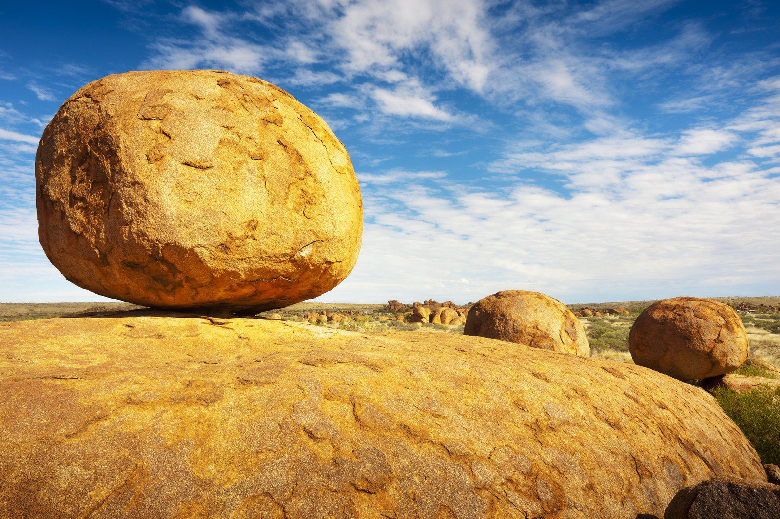
Karlu Karlu (Devils Marbles) Conservation Reserve, Northern Territory Australia
The Karlu Karlu (Devils Marbles) Conservation Reserve is located a 96km, 60 mi, 1:11 hr drive south of Tennant Creek. Karlu Karlu Conservation Reserve can be easily accessed via a short sealed road diversion off the Stuart Highway. The Stuart Highway passes through the middle of the reserve so you will get a good view even while driving. From the carpark a short 15 minute walk will take you to the most famous view of two massive granite boulders seemingly balanced upon the rocks beneath. In addition, you can wander around the many other boulders on the site which covers a large area.
Karlu Karlu to Alice Springs 2WD Road Trip, Northern Territory Australia
The remaining 412 km, 256 mi, 5:08 hr road trip from the Devils Marbles to Alice Springs is very sparse however has a few interesting stopping points which are close to the Stuart Highway. The first stopping point (222 km, 138 mi, 2:44 hrs south of Tennant Creek) is the micropolis of of Barrow Creek, which contains the Barrow Creek Hotel, a service station and the Barrow Creek Telegraph Station Historic Reserve.
After passing through the tiny townships of Ti Tree and Aileron there are a few interesting small reserves which are worth stopping to explore more history of the area. The first is the Ryan Well Historical Reserve (161 km, 100 mi, 2:00 hrs south of Barrow Creek) which has the remnants of a well which was man made in 1889 to encourage settlement of the local area. 14km (9 mi) further south on the Stuart Highway is the Native Gap Conservation Reserve which is an Aboriginal sacred site and contains an unsealed loop track with options to picnic and walk around the reserve.
From the Native Gap Conservation Reserve there is a final 115 km (71 mi) drive on the Stuart Highway to arrive in Alice Springs.
Around Alice Springs, Northern Territory Australia
The township of Alice Springs is the largest in Central Australia with a population of over 25,000 people out of a total Central Australian population of approximately 60,000 people. Alice Springs has an impressive range of attractions to choose from in all directions.
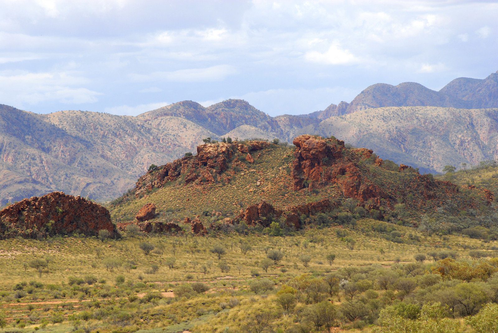
The MacDonnell ranges are a spectacular mountainous feature which dominate the Alice Springs skyline. The Western and Eastern MacDonnell Ranges join at Simpsons Gap which is only a short distance from town.
Alice Springs History
Alice Springs was originally founded as part of the Overland Telegraph which was constructed in 1870 – 1872. The Alice Springs Telegraph Station was established beside a water source which was named Alice Springs. The town which subsequently developed close by was originally called Stuart until 1933, when it was decided to rename the town to Alice Springs to reduce confusion.
Around the Alice Springs Township
The Alice Springs town centre contains Australia’s best selection of Aboriginal art galleries which are centred around the Todd Mall area.
Other attractions around the Alice Springs township include:
- The Alice Springs Telegraph Station Historical Reserve is located 4km north of the township and marks the original site of European settlement in the Alice Springs area. The Alice Springs Telegraph Station also marks the start of the famous Larapinta Trail which is a spectacular 223km walk through the West MacDonnell Ranges to the west of Alice Springs.
- The Olive Pink Botanic Garden is located a short walking distance to the east of the township and contains over 350 different central Australian plants and a good variety of local birdlife. The Olive Pink Botanic Garden has a series of walking trails which have great views across Alice Springs.
- The Royal Flying Doctor Service provides an opportunity to better understand the valuable service provided to outback Australia. Many visitors do not realise that if they are travelling greater than 150km from a town that the Royal Flying Doctor Service will respond in the event of a medical emergency. The RFDS tourist centre is located at the southern end of the central Alice Springs township.
- The Alice Springs Reptile Centre is located over the road from the Royal Flying Doctor Service. On display are a variety of Australian reptiles including central Australian reptiles such as Thorny Devils.
- Kangaroo Dundee’s Kangaroo Sanctuary offers sunset tours where you can walk through the large reserve and see the kangaroos become active at sunset. The tour provides opportunities to hold and touch rescued kangaroos and also learn more about the local Aboriginal culture.
- The School of the Air provides schooling for remotely located Australian children using both radio and internet. The Visitor Centre is located 3.5km north of the town and provides an opportunity to learn more about this essential service, and live lessons may be observed on school days.
- The National Pioneer Women’s Hall of Fame is located to the southwest of the Alice Springs township. On display are exhibitions which detail the impact women made on pioneering the settlement in central Australia.
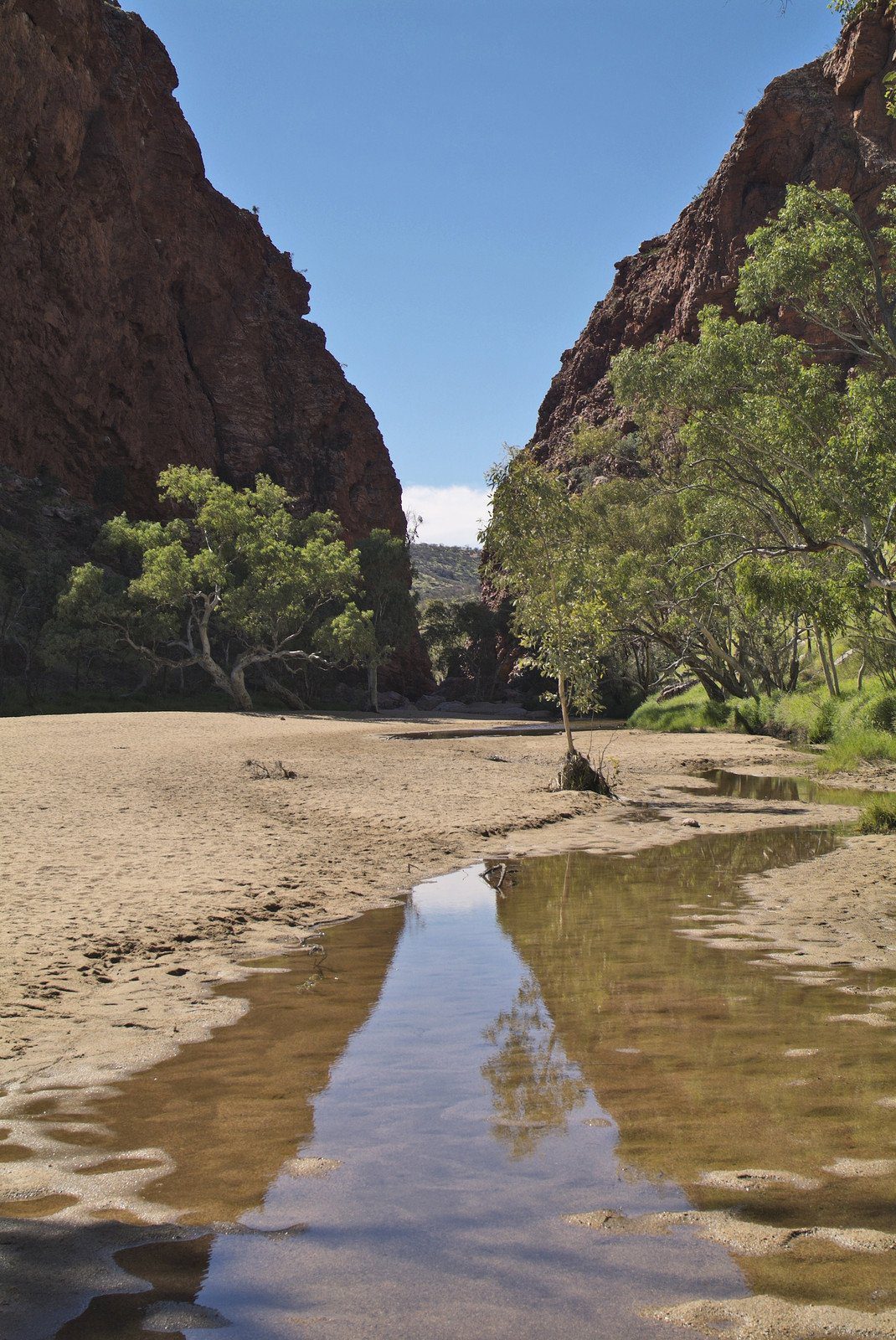
2WD Side Road Trip Option – West MacDonnell Ranges, Northern Territory Australia
An unmissable Alice Springs side trip is the West MacDonnell Ranges National Park which is located on the western side of Alice Springs. With a 2WD vehicle you can easily visit many amazing locations in the National Park. If you are a keen hiker you should plan to walk at least one of the sections of the spectacular Larapinta Trail. There are several local businesses who will pick you up and drop you off at the trail heads which are easily accessible. There are many places along the route where you can swim, however be aware that the water is very cold even in summer and can cause hypothermia.
The sealed Namatjira Drive parallels the West MacDonnell Ranges and the Larapinta Trail as far west as Glen Helen. Driving direct Glen Helen is a 132km, 2:41 hrs one way drive. When you include the various attractions that route increases to become a 181km, 4:07 hr one way drive. Therefore to make to most of your visit you should allow at least 2 days to explore this amazing region. If you have less time available you can choose to only go part way along the route before returning to Alice Springs. Accommodation is available at the Glen Helen Gorge Resort and there are also various camping options along the way.
West MacDonnell Ranges Attractions
For day trippers a comfortable day out with a round trip of 116km, 2:41 hrs is the route from Alice Springs to Standley Chasm and return.
The main attractions on the route from Alice Springs to Standley Chasm are the following:
- The Alice Springs Desert Park (7km west of Alice Springs) is located on Namatjira Drive. The Alice Springs Desert Park provides an appreciation of the unique Central Australian desert vegetation. The bird show is also worthwhile, and you can also get both self guided and guided tours of the park. A nocturnal tour is also on offer in the evenings and provides an opportunity to see local night time wildlife like bilbies and mala.
- The Simpson’s Gap section of the West MacDonnell Ranges National Park (24km west of Alice Springs) is easily accessible by 2WD vehicle. There are a range of transport options to get there from Alice Springs, including walking Section 1 of the Larapinta Trail (24km one way), riding a bike on the Simpsons Gap Bike Path (17km one way), and various bus options. Simpsons Gap itself is directly accessible from the car park and there are a number of other walks around the area.
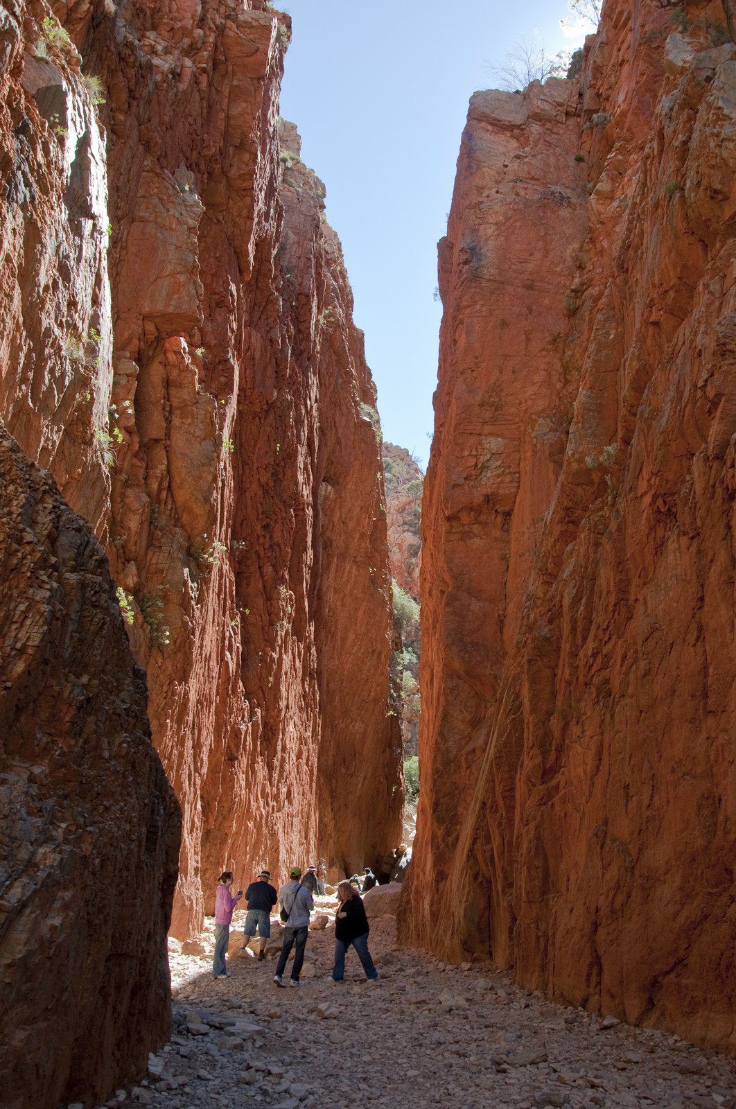
- The spectacular narrow red rock walls of Standley Chasm (Angkerle) (50km west of Alice Springs) is privately operated so you are required to pay an entry fee. The best time of day to visit is midday to maximise the light on the cliffs, however it is also the time when the most visitors are on the site.
For those with more time who intend to stay overnight you should add the following attractions on the way to Glen Helen:
- The Ellery Creek Big Hole (89km west of Alice Springs) is a welcome stop where you can have a swim in the permanent waterhole. The final 2km of the access road is unsealed.
- Serpentine Gorge (98km west of Alice Springs) is a less visited attraction. The final 3km of the access road is unsealed, and from the car park there is a 1.3km walk to reach Serpentine Gorge.
- The Ochre Pits (111km west of Alice Springs) are easily accessible from Namatjira Drive via an 8km sealed road. The Ochre Pits are an active sacred site and visitors are not allowed to touch the ochre. The local aboriginal tribe has utilised this site for thousands of years to collect ochre for use in ceremonies and in trade.
- Ormiston Gorge (135km west of Alice Springs) is a popular almost permanent waterhole which is centrally situated amongst spectacular red rock terrain. The swimming area is located 500m from the visitor centre. There are a variety of both short and longer walks around the visitor centre.
- Glen Helen Gorge (132km west of Alice Springs) used to be a cattle station however the eastern section has now been converted into a tourist resort situated beside Glen Helen Gorge. From the resort the Glen Helen Gorge is a 10 minute walk and visitors can go swimming and also undertake some local walks in the area which provide views towards Mt Sonder, the highest mountain in the region.
Mereenie Loop Road or Red Centre Way
Beyond Glen Helen Gorge the road becomes an unsealed road called the Mereenie Loop Road or Red Centre Way which take you to Kings Canyon and then on to Uluru – note that a permit is required to drive this route and if you are in a hire vehicle you may not be permitted to take your vehicle on this route.
If the weather and road conditions are reasonable you MAY be able to take a 2WD vehicle along the Red Centre Way, however ensure you check the road conditions and fuel options before committing to driving this route. Here is the best map of the route options. Note that Kings Canyon is easily accessible by 2WD once you have driven the longer (but often faster) sealed road route to Uluru. The sealed Uluru/Kings Canyon route will be detailed in the next article in this series.
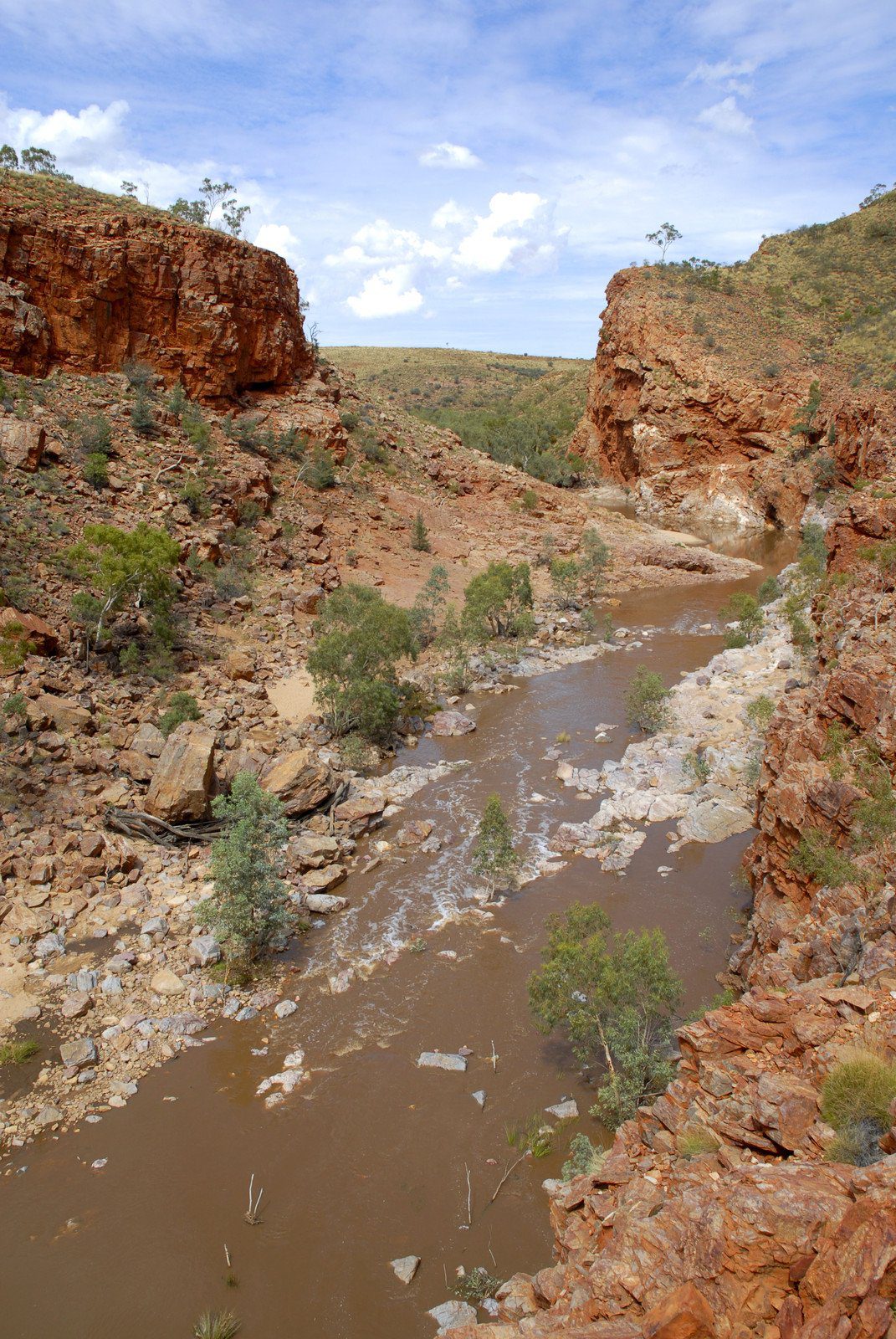
2WD Side Road Trip Option – East MacDonnell Ranges, Northern Territory Australia
A less travelled Alice Springs side trip is the East MacDonnell Ranges National Park which is located on the eastern side of Alice Springs. With a 2WD vehicle you can easily visit several amazing locations.
For day trippers a comfortable day out with a round trip of 152 km, 94 mi, 3:11 hrs is the route from Alice Springs to Trephina Gorge Nature Park and return along the sealed section of the Ross Highway. Here is the best map of the area to plan your visit.
The main attractions on the route are the following:
- The Emily Gap and Jessie Gap Nature Park is located alongside the Ross Highway. Emily Gap (15km south then east from Alice Springs) and Jessie Gap (22km from Alice Springs) both contain Aboriginal rock paintings which are easily accessible. Both sites are registered sacred sites which are associated with the Aboriginal dreamtime story about the caterpillar trail.
- The distinctive dolomite column of the Corroboree Rock Conservation Reserve (50km east of Alice Springs) is located just a few hundred meters from the Ross Highway. A walking path around the base of Corroboree Rock is a good option for visitors to explore the area.
- Trephina Gorge Nature Park (85km east of Alice Springs) can be accessed via a 9km access road, of which the final 5km is a gravel unsealed road which is 2WD accessible. Two gorges pass through the park, however only Trephina Gorge is 2WD accessible. John Hayes Rockhole is only 4WD and hiker accessible. Swimming is possible in both locations, however during summer the waterholes may dry out. A variety of both short and long walks are available through the park. The picturesque largest Ghost Gum tree in the East McDonnell Ranges is easily accessible from the unsealed road within the park.
- The sealed Ross Highway continues on to the close by Ross River Resort which offers a basic range of accommodation and amenities. You will need a 4WD vehicle to access the thousands of rock petroglyphs in the N’Dhala Gorge Conservation Reserve which is past the Ross River Resort.
- The Arltunga Historical Reserve can be accessed via a 2WD accessible 36km unsealed road which commences 5km past Trephina Gorge. At Arltunga you will see the ghost town of the first real settlement in Central Australia which was established when gold was found.
- You will need a 4WD vehicle to travel the 40km past Arltunga to visit the ruby-like red garnet stones of Ruby Gap Nature Park.
- For the return route you can return along the same route back to Alice Springs. A good option would be to do the long drive to Arltunga first then work your way back to Alice Springs.
Northern Territory Trip Tips: When to Visit & Dangers
Weather
The Stuart Highway is vehicle accessible all year round except in the event of major flooding.
The Red Centre is a semi-arid region which has four seasons. Summer occurs over December to February where maximum temperatures of 20C to 35C occur (68F to 95F). Winter occurs over June to August where maximum temperatures of 3C to 20C occur (37F to 68F), and correspondingly cold nights. Spring and autumn provide the transition between the two extremes.
Join the Australia Travel Planning Facebook Group
Check out our Australia Travel Planning Facebook Group – you are welcome to join and it is a great resource to enable you to ask questions about your Australian trip!
Disclaimer: This article contains affiliate links. If you book after clicking on one of these links then we may receive a small commission at no extra cost to you.

Anne Sutherland-Smith is the creative force behind Pretraveller.com, a travel blog that specializes in offering insightful guidance for exploring Japan, South Korea, Australia, Hong Kong, and Singapore. Her passion for these diverse and dynamic regions shines through in her expert advice, particularly in helping travellers stay connected with the latest in SIM cards, pocket WiFi, and eSIMs.
With an unquenchable thirst for Asian and Oceanian cultures, Anne has carved out a niche as a knowledgeable guide for those venturing into the bustling streets of Tokyo, the historical alleys of Kyoto, the vibrant scenes of Seoul, the scenic landscapes of Australia, the vibrant markets of Hong Kong, or the futuristic cityscape of Singapore. Her articles are full of practical tips and detailed information, ensuring travellers are well-equipped for their journeys.
Anne’s approach is grounded in providing reliable, authoritative travel content that enhances the travel experience. From navigating the complexities of digital connectivity on the go to immersing in the local culture, her advice is designed to make travel both enjoyable and seamless.
Karlu karlu looks awesom..Lotz of information you have shared and cool picks…
Thanks for your comment. The Devils Marbles are definitely a place I plan to visit.
West McDonnell Ranges National Park is awesome,Last month i visited the here with friends and really great fun .
Thanks for your comment. It is good to hear that you enjoyed the West MacDonnell Ranges, they are a fabulous natural feature.
See the Devils Marbles on a bright moonlight night they are awesome,the rocks take on a silver appearance.
William, thanks for your comment. It sounds like you had a really special experience to see the Devils Marbles at night!
Beautiful shots of the West MacDonnell Ranges and the devils marbles!
Thanks for the useful post. I have driven Adelaide to Coober Pedy before, may have to try to head further afield next time 🙂
Sharon, I am eventually planning to extend the road trip series from Uluru to Adelaide! So watch this space…